
The 15th of March 2019 will remain evergreen in the minds of Zimbabweans, especially residents of Chimanimani, a bustling township in the eastern region of Zimbabwe. On this day, the country got hit by Cyclone Idai, the most devastating natural disaster its people have ever seen. Its attendant immeasurable destruction knew no bounds. It extended into the borders of Mozambique and Malawi, causing a humanitarian crisis in them. Almost 800,000 hectares of agricultural land got destroyed.
Natural disasters like this are one of the adverse effects of the fast-changing nature of the earth’s climate. And Zimbabwe, like the rest of the world, is vulnerable to climate change. This natural phenomenon particularly has costly effects on the country’s agricultural sector, a determiner of its economic performance. The sector contributes approximately 17% to Zimbabwe’s GDP while employing about two-thirds of the population.
Despite this immense contribution to the economy, an antithetical reality is that food security is still a challenge, and many still go to bed hungry. An estimated 5.3 million Zimbabweans, which is 0.5 million more than the estimated 4.8 million at the start of the harvest season in May 2022, were with insufficient food. Hence, achieving food security is paramount, and one of the most efficient ways to do this is to leverage technology in the agricultural industry.
One of the vanguards of this innovative course is EOS Data Analytics, a global provider of AI-powered satellite imagery analytics for 22 different industries with a focus on agriculture and forestry. The company is making agriculture easy with space technologies by empowering agribusinesses with the latest technologies, which are crucial to the country’s development.
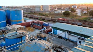
With its AI-driven solutions, users (farmers) can remotely map land and monitor and control plant and soil conditions on their fields. However, as with the African continent, getting these solutions to farmers in rural areas plagued with infrastructural deficits like no electricity and low internet access is a challenge. To scale this hurdle and widen its solutions’ reach, EOSDA partnered with TelOne, a government-owned company providing communications and digital solutions for customers in Zimbabwe. This will enable TelOne to establish itself in the smart agriculture sector and assist the government, farmers, financial institutions, and other players in the agriculture value chain to create economic value.
In an interview with Ventures Africa, Brijesh Thoppil, Strategic Partnerships Lead at EOS Data Analytics explained that “Humanity’s going through rapid changes that require us to make quick digital transformations. Since Africa is to become a global hub for agritech, new developments in the African agricultural sector and Zimbabwe can bring multiple benefits to the stakeholders and uplift the smallholder farmer communities. That is why we are so excited about this strategic partnership with TelOne. They provide telecom services and solutions for their customers in Zimbabwe.”
“About 95 % of farmlands are in rural areas, and internet connectivity slows the adoption rate of precision agriculture there. Partners like Telmond will be able to address those challenges regarding internet or data connectivity for the beneficiaries of such solutions. That propelled us to have a partnership with them,” he added.
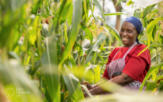
EOSDA and its product offerings for farmers in Zimbabwe.
EOSDA’s main product in the agriculture industry is EOSDA Crop Monitoring, a digital precision agriculture tool that ensures the timely detection of crop health issues, including water stress, diseases, pests, and weeds, amongst others. Early-stage detection of these anomalies expedites the decision-making process, allowing farmers to save time, reduce costs, and increase yields. The tool also provides a 14-day weather forecast for each field for more flexible planning against unexpected weather events that can tamper with crop productivity levels.
“We are on the way to improving agritech practices in Africa, not just for agribusinesses but also for smallholder farmers. All these help uplift the agritech industry in Africa and bring Africa to the global stage of this particular industry,” Thoppil said.
There is also the EOSDA Land Viewer, a satellite observation imagery tool that allows farmers to search, process and get valuable insights from satellite data. The tool gives instant access to a wealth of historical and current satellite images that can be processed into images suitable to user needs, saving time and using less space on the user’s device.
Another product offering – EOSDA Forest Monitoring, offers a solution for precise forest management, a satellite-based forest monitoring tool. Foresters can use the platform, owners, researchers, and logging companies interested in remotely monitoring forest health risks, identifying illegal logging, and reducing negative environmental impacts.
Cross-border impact and partnerships.
While there are no direct offices in Africa, EOSDA has established strategic partnerships on the continent before Zimbabwe. An instance of this strategic partnership is with AgroXchange in Nigeria and Complete Farmer in Ghana.
More than 10 million smallholder farmers in Nigeria make uninformed decisions on applying fertilizers and seeds, which results in over $10 billion in annual losses across the entire agricultural value chain. The partnership with AgroXchange, a digital profiling platform that facilitates access to market, credit, and inputs for farmers in Nigeria, helped mitigate this loss by embedding satellite crop monitoring in smallholder farming processes.
In 2021, the Central Bank of Nigeria established the Anchor Borrowers’ Program, which provided loans to smallholder farmers to aid them in improving yields. To make decisions to give credit to farmers, the government determines the viability of farm clusters in terms of productivity and availability of resources to sustain the farm through the seasons. However, methods of deciding the viability of farms, like drones to monitor changes in the farm fields, have their pitfalls.
Agroxchange (EOSDA’s partner) helped the Federal Government transition to satellite monitoring to assess changes in cultivated land use, notably validating farms in terms of productivity to support loan decisions within the Anchor Borrowers’ Program. Agroxchange adopted the EOSDA Crop Monitoring platform for the assessment, starting out on 100,000 hectares of farmland. By September 2021, the project had scaled to about 400,000 hectares of farmland. Data derived from crop monitoring helps with planning for incoming planting seasons.
In Ghana, the use case with Complete Farmer‘s partnership is similar. EOSDA’s crop monitoring product gets insights into how well the farmers use credits offered to them.
These success stories are not devoid of challenges. Many farmers come from rural areas. Importantly, these farmers are less likely to adjust to advanced technology instantly. Introducing hi-tech solutions, especially to farmers who may not know how to use such technologies is a big challenge. Hence, educating farmers is paramount for technology adoption. And this can be capital-intensive.
However, Toppil revealed that EOSDA has a development programme through which they transfer the much-needed expertise to regional partners on the continent. Through this programme, partners can contribute to the training and education of farmers and local market players. These efforts help accelerate the social and economic well-being of agricultural players.
EOSDA is unrelenting in serving its clients seamlessly with more high-end and ambitious innovative solutions. In forty-seven days, the company will be launching its EOS SAT-1 – the world’s first agri-focused satellite constellation, among companies utilizing remote sensing technologies, uniquely designed to serve agricultural purposes. The EOS SAT satellites will feature 1.4 m panchromatic and 2.8 m multispectral Ground Sample Distance (resolution), 11 band channels, and a swath width of up to 40 km.
“The key objective of this satellite is to have full capacities to monitor the farmlands. This will increase the data quality, accuracy and efficiency. I believe this improvement will encourage more African companies like those strategic partners we have to focus on precision farming and implement agricultural technologies in Africa,” Thoppil stated.