
Climate change is taking a toll across East Africa with increasingly erratic weather conditions. From recurring droughts to heavy rains is becoming commonplace in countries such as Kenya, Somalia, Uganda and Ethiopia. So far, 12 million people have been affected and this could double if nothing is done.
In securing its future in Agriculture, Kenya is set to launch its first localized weather modelling system early next year. The modelling system known as climate atlas, will provide key data on how climate change will likely impact crop production across the East African nation in the decades to come.
The project was developed by researchers at Kenya’s Jomo Kenyatta University of Agriculture and Technology. The model was first developed in the Netherlands and is used by provincial authorities for planning purposes. It is also being developed for Bangladesh and Indonesia.
Climate Atlas will provide projections on rainfall and temperature patterns across Kenya’s 47 counties from the year 2050 to 2100. It is also expected to provide future scenarios of what the weather patterns will be like at a county-level in Kenya.
Also it will provide data with the highest and lowest temperatures and rainfall, how high and low temperatures and rainfall are likely to be, what time of year they will happen, and how long it is expected to last.
Based on its projections, businesses, policymakers, researchers and farmers will be able to shift to interventions from using more resilient crop varieties to improve drainage during drought and floods respectively. Also, localized long-term climate mapping would ensure investments in agriculture production is wisely done.
More so, investing in irrigation will be useful if more droughts are predicted, but if the long term prediction is that rainfall will increase, a different investment such as greenhouses for tomato production might be more sensible.
John Wesonga, the lead developer of the web-based Climate Atlas platform, said there were countless global climate modelling systems available, but none provided localized data for Kenya over a long period.
Since October, Kenya has witnessed floods sparked by heavy rains which have inundated farmland, destroyed infrastructure and killed at least 48 people in central, western, northeastern and coastal parts of the country.
According to the National Drought Management Authority, Kenya was already facing increased levels of hunger prior to the flood, with more than three million people projected to be in crisis and emergency levels of food insecurity
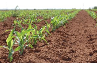
Agriculture is the engine of economic growth in Kenya. About 75% of Kenyans earn all or part of their income from this sector. Agriculture accounts for 33% of the nation’s gross domestic product GDP. With this climate atlas, disasters caused by flooding and drought will be prevented. Not just that, it will also help the government to better handle climate situations, thus securing and improving the lives and properties of people.
By Faith Ikade.